Client: Sub-consulting to Nelson/Nygaard on a project for the Detroit Economic Growth Corporation
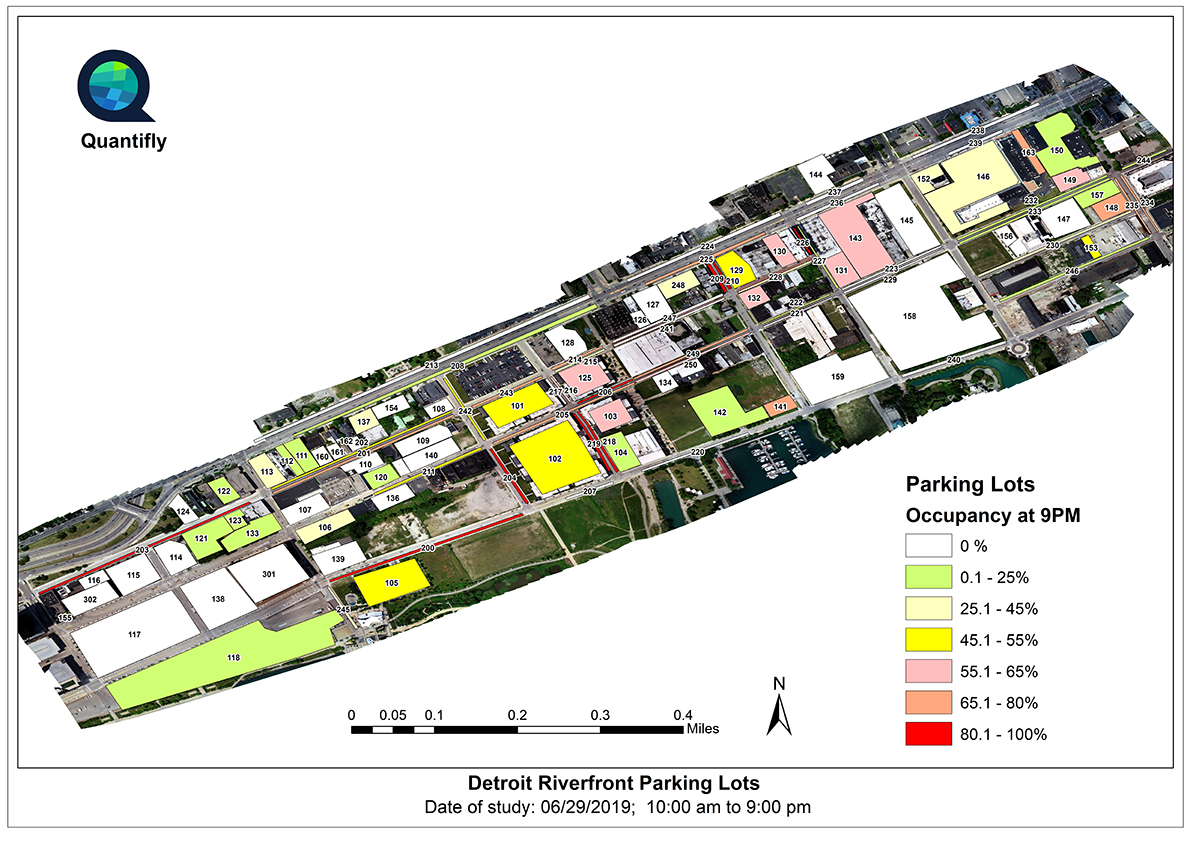
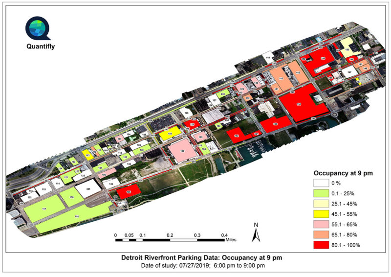
This study focused on parking availability along a recreational riverfront, and was conducted in two phases. The first phase represented typical Saturday conditions, and the second phase was solely to measure the impact of a large concert on the riverfront’s on- and off-street parking supply. The project area was approximately 200 acres (three square miles) and included 6,800 parking spaces.
The first phase took place on Saturday, June 29, 2019 and included 12 hourly UAV flights between 10 am and 9 pm. Over the course of the day, 12,782 total cars were counted. The second phase took place on Saturday, July 27, 2019 and included four hourly UAV flights between 6 pm and 9 pm. In just that three hour period, 9,412 cars were counted. Due to battery limitations and the FAA’s beyond visual line-of-sight (BVLOS) restrictions, four UAV pilots were necessary to cover all 200 acres.
The Detroit case study aerial graphics contrast the parking occupancy at 9 pm on a regular Saturday night, and at 9 pm on a Saturday night when a concert event is occurring. The Excel graph shows the “DNA” of a parking lot and the turnover of its individual parking spaces throughout the day, and highlights Quantifly’s ability to gather granular data.


